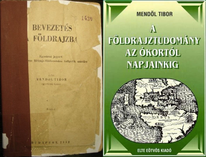
Fantom a múltból: Mendöl Tibor „Bevezetés a földrajzba” újra kiadott tankönyvének posztszocialista ellentmondásai

Ez ez előadás egy prominens magyar geográfus eredetileg az 1950-es években írt tankönyvének posztszocialista időszakbeli újrakiadásának körülményeit tárja fel, és a magyar posztszocialista geográfia „nagy történeti hézagának” ellentmondásos narratíváiban értelmezi. Mendöl Tibor „Bevezetés a földrajzba” című egyetemi jegyzete egy kettős narratívában íródott hibrid szöveg: egyfelől az előző konzervatív-nacionalista rezsim hagyományos „felfedezések története” narratívája, másfelől a későbbi szovjetizált rezsim kötelezően átvett marxista-leninista nyelvezete hatja át. 1999-ben a szöveg két rehabilitátorát, Perczel Györgyöt és Probáld Ferencet egészen különböző motivációk vezérelték (mint például egy letűnt, egykor dicsőséges földrajzi hagyományhoz való visszatérés, vagy a diszkreditált szocialista múlt szelektív elfedése), ám mindkét esetben a szerző szimbolikus átértelmezését követték el. Ez végső soron a szöveg önkényes átszerkesztéséhez vezetett, először is a kompromittálónak talált részek kitörlésével, másodszor a mű „teljes” történeti ívének „befejezése” általi újrakeretezésével, harmadszor pedig az ideológiailag terhelt szövegrészek szelektív és nem teljes „lefordításával” egy deideologizált formába. Az előadás célja rétegről rétegre bemutatni a szöveg történeti kontextusait, ugyanis a szövegértelmezési és történeti újraértelmezés nélkül az olvasó úgymond benn ragad Mendöl összeszőtt kettős narratívájának „hermeneutikai csapdájában”. Az előadás utolsó részében a tankönyv dicsőséges „felfedezések története” narratívája és világtörténeti, geopolitikai képzelete mai újraértelmezési lehetőségeit mutatom be a kritikai elmélet anti-eurocentrikus szakirodalmán keresztül.

Phantom of the past: Postsocialist contradictions in Tibor Mendöl’s republished “Introduction to Geography” textbook

This paper aims to unravel the contextual layers of the postsocialist republishing of a prominent Hungarian geographer’s textbook originally written in the 1950s, which is considered here as a vehicle of the contested narrativity in the “big historical gap” of postsocialist Hungarian geography. Tibor Mendöl’s Introduction to Geography was a hybrid text written in a dual narrative: first in a traditional “age of discoveries” narrative of the previous conservative-nationalist regime, and second in the obligatory Marxist-Leninist language of the later Sovietized regime. In 1999, the two rehabilitators of the text, György Perczel and Ferenc Probáld, were driven by different motivations (such as the return to a formerly glorious geographical tradition, or the selective confining of a discredited socialist past), but in both cases through a symbolic contestation of the author. This ultimately led to the arbitrarily reediting of the text, first by deleting its most compromising parts, second by reframing it in a “completed” form by “finishing” its historical span, and third by selectively and incompletely “translating” some of its burdened phrases into a partly de-ideologized language. My aim is to provide a layer-by-layer historical analysis of the text’s contexts, because without a dense hermeneutical and historical reinterpretation, we are entangled in the “hermeneutic trap” of Mendöl’s interwoven dual narrative. The last part of my presentation provides possible reinterpretations of the textbook’s triumphalist “age of discoveries” narrative and world historical, geopolitical imagination in light of the critical theories of anti-Eurocentric literature.

See my publication: Gyimesi, Z. (2014): The Contested Post-Socialist Rehabilitation of the Past: Dual Narratives in the Republishing of Tibor Mendöl’s “Introduction to Geography”. Hungarian Cultural Studies, 7: 242–273. https://ahea.pitt.edu/ojs/index.php/ahea/article/view/172

© Zoltán Ginelli

Citation:

Ginelli Z. (2020): Fantom a múltból: Mendöl Tibor „Bevezetés a földrajzba” újrakiadott tankönyvének posztszocialista ellentmondásai. Kritikai Földrajz Blog, 2020.07.18. Link:

Critical Human Geography in Hungary? Structural Dependencies and Knowledge Circulation in a Semiperipheral Context

Képtalálat a következőre: „fence hungary”

Knowledge filtration under structural constraints
(Source: https://www.middleeasteye.net)

Book chapter proposal for Political Ecology in Eastern Europe, edited by Eszter Krasznai Kovács

This chapter provides a critical overview of how Hungarian human geography developed since 1989, by showing the long-term continuities and structural shifts in local intellectual positions and knowledge epistemologies from a world-systemic perspective, reflecting on how structural dependencies have shaped local knowledge production strategies and disciplinary identity politics in a semiperipheral context. This account offers a perspective on how institutional settings and narrative networks developed according to the various rounds of Hungarian geographers’ semiperipheral integration and re-integration into hegemonic knowledge structures from the late socialist era to neoliberal “return to Europe” and European Union accession, until today’s post-2010 authoritarianism and “global opening”.

In this context, this chapter focuses on how “critical geography” in Hungary was defined and why has its formulation ultimately failed? Can we identify “critical geography” at all compared to its original Western conception? What might be the challenges for any “critical geography” after the 2008 crisis and the authoritarian “illiberal” turn since 2010? These questions are explored through insights from the history and sociology of scientific knowledge, including epistemic strategies of academic provincialism, connectivity, entitlement and gatekeeping. The literature on the geographies of knowledge elucidates the selective circulation, inclusion/exclusion dynamics and local interpretation of Western approaches to human geography, in order to understand how they got positioned and translated into local knowledge interests with very different social and political functions in a semiperipheral structural context. The chapter points out that Hungarian authors either completely dismissed or unreflectively reproduced the Anglo-American postpositivist canon through narrative and epistemological dependency, evading critical self-reflection, historically contextualized and comparative engagement with Anglo-American and Hungarian geography in the “knowledge transfer” of “catching up” to the West.

Meanwhile, amidst the global rise of conservative nationalist authoritarianism, recent Hungarian government attacks against leftism, liberalism, Marxism, feminism and gender studies, race studies, the “1968 generation” and the 1989–2010 liberal period have complicated the interpretive context of West-imported “critical geographies”. The “illiberal” Christian-nationalist Kulturkampf revived geopolitics and global historical approaches (e.g. turn to Asia), while mischievously appropriated postpositivist criticism, postmodernist representational and identity politics, and postcolonial or decolonial ideas as molded into nationalist victimization, anti-Western or anti-EU rhetoric, civilizational exceptionalism and color-blind racism. This chapter aims to critically reflect on how East-West knowledge dependencies in geography constrain meaningful criticism of these processes, and argue for re-evaluating Hungarian “critical geography” based on a historically and geographically self-reflexive world-systemic engagement with the (de)colonization and self-colonization of geographical knowledge.

© Copyright – Content is protected by copyright!

Citation:

Ginelli Z. (2019): Critical Human Geography in Hungary? Structural Dependencies and Knowledge Circulation in a Semiperipheral Context. Critical Geographies Blog. Link: /2019/07/24/critical-human-geography-in-hungary-structural-dependencies-and-knowledge-circulation-in-a-semiperipheral-context

The shifting hegemonic relations between American and German human geography in light of the quantitative revolution, 1900-1970s

This research project looks at two intertwined processes in the history of North American and German geography from the early 20th century to the 1970s. First, the shifting hegemonic relations between “theory-importer” United States and “theory-exporter” German human geography, in which a formerly peripheral US geography triumphed over its German counterpart and became hegemonic after WWII; second, this shift was connected to the post-WWII quantitative revolution in US and Canadian geography during the 1950s and 1970s, in which the discipline became a mathematical and rigorous Cold War spatial science. This project follows a transnational historical perspective in the historical geographies of scientific knowledge to look at how geographical knowledge circulated and interacted between North America and Germany. It does so by analyzing the influence and circulation of German geographical knowledge and location theories, most notably central place theory in urban and regional planning, which became a paradigmatic theory of Cold War geography internationally, and later re-influenced German geography from the late 1960s from the US. The research project is based on archival research and career path interviews with scholars connected to the quantitative revolution.

Tracing the Global History of the Quantitative Revolution: The Transnational History of Central Place Theory

christaller_cpt2

Zoltán Ginelli

Book Plan

The quantitative revolution has been an epochal textbook chapter in geography’s canonical history, marking a time when the discipline transformed into a rigorous social science backed by predictive mathematical methods in the early Cold War. An iconic scientific concept of this quantitative movement, most notably related to Walter Christaller (1933) and August Lösch (1939), was central place theory (CPT), which postulated a triangular-hexagonal structure of hierarchical settlement systems based on marginalist economics and behaviourist assumptions. It was a foundational theory for the emerging field of spatial analysis, including regional science (Isard, 1956) and regional or urban economics. With the intensive globalization of the quantitative revolution after its emergence from the Second World War in the United States (Barnes and Farish 2006), location theories such as CPT became very influential and widespread in urban and regional planning across the entire world. But in the West, vigorous efforts to criticise spatial science from the 1970s onwards (e.g. Gregory, 1978) developed a revisionist narrative that stressed the influence of positivism, rationalism, technocratism, and Cold War American hegemony. This ultimately added to the already reduced view of actual historical events (Livingstone, 1992; cf. Van Meeteren, forthcoming), while recent research has only begun to unravel the variegated geographical contexts of the quantitative revolution (e.g. Barnes, 2003). Reflecting on its initial North American centres, Barnes (2002, 508) passingly remarked: “Why are places in Africa not on there, or Asia, or Australasia?” Following Barnes’s plea for a more wider interpretation, we attempt to pose a number of questions. How did quantitative spatial analysis and planning develop in different parts of the world? In what different geographical contexts were location theories like CPT read, reinterpreted, applied, and mobilized? How were these often very different contexts connected?

This book offers to fill this significant gap in geography’s twentieth century global history by following a transnational framework based on the historical geographies of scientific knowledge (Livingstone, 2003; Withers, 2007). It aims to deconstruct the mainstream Anglo-American narrative by tracing the quantitative revolution through the circulation and local applications of CPT in the “Second” and “Third” worlds and also into the pre-Cold War era (Ginelli 2018; Ginelli, in preparation). CPT was abstracted and canonized pragmatically by American-led spatial science despite originating from a much wider and more complex European interwar discourse than commonly appreciated (Radeff, 2012; Van Meeteren and Poorthuis, 2018). Antecedents reached into late 18th and 19th century ideas by German, French, and Swiss political economists, engineers, mathematicians, and geographers (Istel, 2002), and the so-called Garden City Movement across Europe (Fehl, 1992). The discussion of location theories grew rapidly in interwar Europe, as the Great Depression (192933) and world economic crisis ignited state-led interventionism and technocratism, which was embedded in a transnational discourse of rationalizing reforms by emerging administration science and regional planning, the application of functionalist and modernist ideas, Fordist-Taylorist development, mathematical economics, and long-term planning that disregarded ideological barriers. During the Second World War, CPT was intensively applied by Christaller under the “reactionary modernist” Nazi regime to plan the colonization and German resettlement of Poland by the Third Reich (Generalplan Ost) (e.g. Rössler, 1989; Preston, 2009; Barnes and Minca, 2013). Notable early applications included Estonia (Kant, 1935), the Nordoostpolder settlements in the Netherlands in the 1940s (Bosma 1993), the new settlements of expanding Israel in the mid-1950s (Trezib, 2014), research and application in regional planning in Britain (e.g. Dickinson, 1942; Smailes, 1944), introduction to the USA (Ullman, 1941; Brush, 1953; Berry & Garrison, 1958), and the regional planning of Sweden (e.g. Godlund, 1951). The yet weak American, British, and Canadian network of the quantitative movement was supported by the Swedish hub in Lund, which was also important in disseminating the application of location theories into Scandinavia and other parts of Europe in the 1960s (Barnes and Abrahamsson, 2017; Van Meeteren, in preparation). The Anglo-American impulse traversed easily into other Anglophone contexts such as Australia and New Zealand (e.g. Duncan 1955), and reached France through Canada in Francophone networks (Cuyala, 2015), while it helped legitimize the German reinvigoration of CPT in the 1960s in face of its wartime burden (Kegler, 2015).

These mostly North Atlantic and Western, Central, and Northern European cases were followed by parallel developments and were increasingly connected into a global network despite Cold War ideological tensions, especially through international organizations such as the International Geographical Union and urban or regional planning organizations. The globalization of CPT under American Cold War hegemony from the early 1960s led to the Americanization of German location theories in an economistic modernization discourse, supported by USAID, United Nations, and World Bank projects. CPT became an important instrument of state-interventionist modernization and urbanization policies in the “planning laboratories” of the Global South, embedded in existing and emerging postcolonial knowledge networks devised by important centres of the quantitative revolution (Ginelli, in preparation). Early applications in India were followed by various others in South East Asia, West Asia (Clark & Costello 1973), and also East Asia (Ullman 1956), such as China (Skinner, 1964) and Japan (Hayashi, 1973). New statistical surveys and development projects made possible mostly American or British initiatives of applying CPT in African countries, such as Ghana (Grove & Huszár, 1964; Gould; McNulty 1969), Nigeria (Mabogunje, 1968), Kenya (Soja, 1968), South Africa (Carol, 1952; Davies, 1967) amongst many others. In South America, development projects in Peru, Chile (Berry, 1969), Colombia, or Bolivia also applied CPT, and the quantitative revolution spread through modernizing regimes as the case of Brazil suggests (Lamego, 2015; 2016). A number of comparative and critical works of applying CPT in the Global South appeared (e.g. Kuklinski 1978). In the socialist world, after the Stalinist purge of internationally renowned mathematical economics during the 1930s and 1950s, there developed a parallel “mathematical thrust” and growing East-West exchange during the détente of the 1960s (Jensen & Karaska, 1969; Saushkin, 1971). Soviet and Eastern Bloc reformism and the institutionalization of urban and regional planning in the mid-1950s summoned CPT in the service of centralized and long-term state planning, which ignited debates of adaptability between “socialist” and “capitalist” contexts, and also between domestic industrial or welfare policies (Ginelli, forthcoming). CPT strongly influenced the national urban and regional planning concepts of Eastern European countries, where it was already well known, Hungary, Yugoslavia, Poland, Czechoslovakia, and Romania (e.g. Perczel & Gerle, 1966; Vrišer, 1971). Apart from diffusing through Comecon plan coordination, socialist planning discourse borrowed from a transnational pool of knowledge. Quite remarkably, the seemingly “neutral” mathematical-geometrical language of CPT and the political demand for national development plans interweaved “socialist” and “capitalist” contexts, which held important continuities into the postsocialist era (Ginelli, forthcoming; in preparation). With the “new economic geography” emerging in the 1990s, the already developed canon of location theories such as CPT were solidified in neoclassical economics and neoliberal policies connected to a new regionalism.

Drawing on a number of such case studies, this book project aims to connect, contest, and contribute to various fields in the history of scientific knowledge. First of all, it explores the global histories of geography, regional science, urban studies, economics, and related fields in a period marked by geopolitical transitions such as the Second World War, decolonization, and the end of the Cold War. Arguing for a global discourse of CPT, this book contests current disciplinary accounts by re-addressing issues of narrativity, historical periodization, and geographical foci. It aims to broaden the fields of intellectual history and the sociology of science by connecting to the approach of science and technology studies to trace the spatial biographies of various actors, including people, ideas, theories, data, practices, technologies, or capital (e.g. Daston 2000). The yet unwritten transnational history of CPT and spatial analysis fits into the burgeoning literature on the transnational histories of Cold War technosciences, such as mathematical economics, statistical analysis, cybernetics, ekistics, systems theory, linear programming, game theory, or diffusion analysis (e.g. Andersson & Rindzeviciute 2015). This book also contributes to the growing studies of architectural history and policy mobilities, and the history of urban and regional planning with the aim to rethink postwar planning history (Ward, 2010; Wakeman 2014). On a further account, the book reveals the uneven power relations in global knowledge production and thereby adds to postcolonial and decolonial studies by decentering dominant Anglo-American knowledge production by focusing on interconnectivity and peripheralized contexts.

References

Andersson, J. & Rindzeviciute, E. (eds.)(2015): The Struggle for the Long-Term in Transnational Science and Politics: Forging the Future. London: Routledge.

Barnes, T. J. (2002): Performing economic geography: two men, two books, and a cast of thousands. Environment and Planning A, 34: 487–512.

Barnes, T. J. & Minca, C. (2012): Nazi Spatial Theory: The Dark Geographies of Carl Schmitt and Walter Christaller. Annals of the Association of American Geographers, 103(3): 669–687.

Barnes, T. J. & Abrahamsson, C. C. (2017): The imprecise wanderings of a precise idea: The travels of spatial analysis. In Jöns, H., Meusburger, P. and Heffernan, M. (eds.): Mobilities of Knowledge. Dordrecht: Springer. 105–121.

Berry, B. J. L. & Garrison, W. L. (1958): The functional bases of the central place hierarchy. Economic Geography,
34(2): 145–154.

Berry, B. J. L. (1969): Relationships between Regional Economic Development and the Urban System: The Case of Chile. Tijdscrift voor Economische en Sociale Geografie, 60: 283–307.

Bosma, K. (1993): Verbindungen zwischen Ost- und Westkolonisation. In: Rössler, M., Schleiermacher, S. (eds.): Der “Generalplan Ost”: Hauptlinien der nationalsozialistischen Planungs- und Vernichtungspolitik. Berlin: Akademie Verlag. 198–214.

Brush, J. E. (1953): The Hierarchy of Central Places in Southwestern Wisconsin. Geographical Review, 43(3): 380-402.

Carol, H. (1952): Das Agrageographische Berachtungssystem. Ein Beitrag zur Landschaftkundlichen Methodik dargelegt am Beispiel der in Südafrika. Geographica Helvetica, 1: 17–67.

Christaller, W. (1933): Die zentralen Orte in Süddeutschland. Jena: Gustav Fischer.

Clark, B. D. & Costello, V. (1973): The Urban System and Social Patterns in Iranian Cities. Transactions of the Institute of British Geographers, 59: 99–128.

Cuyala, S. (2015): Mapping the sources of diffusion and the active movements of scientists by using a
corpus of interviews: An experiment about the origins of theoretical and quantitative geography in French-speaking Europe. Terra Brasilis (Nova Série), 5.

Davies, R. J. (1967): The South African urban hierarchy. South African Geographical Journal, 49(1): 9–20.

Daston, L. (ed.)(2000): The Biographies of Scientific Objects. Chicago & London: The University of Chicago Press.

Dickinson, R. E. (1947): City, Region and Regionalism. London: Meuthen.

Duncan, J. C. (1955): New Zealand Towns as Services Centres. New Zealand Geographer, 11(2): 119–138.

Fehl, G. (1992): The Nazi Garden City. In: S. V. Ward (ed.): The Garden City: Past, Present and Future. Milton Park & New York: Taylor and Francis. 88–106.

Ginelli, Z. (in preparation) The historical geographies of the “quantitative revolution”: Towards a transnational history of central place theory. Ph.D. Dissertation. Budapest: Eötvös Loránd University, Faculty of Science, Doctoral School of Earth Sciences, Geography-Meteorology Program.

Ginelli, Z. (2018, forthcoming): Globalizing the “quantitative revolution”: The “technocratic turn” in geography and spatial planning in socialist Hungary. In: Idem (ed.) Technosciences of Post/socialism.

Ginelli, Z. (2018): Critical Remarks on the “Sovietization” of Hungarian human geography. In:

Godlund, S. (1951): Bus Services, Hinterlands and the Location of Urban Settlements in Sweden, especially in Scania. Lund.

Gregory, D. J. (1978): Ideology, Science and Human Geography. London: Hutchinson & Co.

Grove, D. J. & Huszár, L. I. (1964): The Towns of Ghana. Accra: Ghana Universities Press.

Gunawardena, K. A. (1964): Service centres in southern Ceylon. University of Cambridge, PhD Thesis.

Hayashi, N. (1973): On the Spatial Features of the Central Functions in Tokai Area. The Human Geography, 25: 26-52.

Istel, W. (2002): Zentrale Orte und ihre Einzugsbereiche. Theorien, empirische Untersuchungen, raumordnerische Anwendungen bis 1945. Ein Lese- und Lehrbuch in zwei Teilen. Tl.1. Prae Christaller. Zentrale-Orte-Theorien und empirische Zentralitätsuntersuchungen zwischen 1809 und 1933/34. Entmytholosierung einer Theorie, München : Fachgebiet Raumforschung, Raumordnung u. Landesplanung, Techn. Univ. München.

Jensen, R. G. & Karaska, G. J. (1969): The mathematical thrust in Soviet economic geography: Its nature and significance. Journal of Regional Science, 9: 141–152.

Kant, E. (1935): Bevölkerung und Lebensraum Estlands. Ein Anthropoökologischer Beitrag zur Kunde Baltoskandias. Tartu: Akadeemiline kooperatiiv.

Kegler, K. R. (2015): Deutsche Raumplanung. Das Modell der “Zentralen Orte” zwischen NS-Staat und Bundesrepublik. Paderborn: Ferdinand Schöningh.

Kuklinski, A. (ed.)(1978): Regional Policies in Nigeria, India and Brazil. The Hague: Mouton de Gruyter.

Lamego, M. (2015): Genius loci Duas versões da geografia quantitativa no Brasil. [Genius loci: two versions of quantitative geography in Brazil.] Terra Brasilis (Nova Série), 5: 114.

Lamego, M. (2016): Sobre a geografia da ciência: perspectivas locais e transnacionais nas histórias da geografia quantitativa brasileira. [On the geography of science: local and transnational perspectives in Brazilian quantitative geography]

Livingstone, D. N. (1992): The Geographical Tradition: Episodes in the History of a Contested Enterprise. Malden and Oxford: Wiley-Blackwell.

Livingstone, D. N. (2003): Putting Science in Its Place: Geographies of Scientific Knowledge. Chicago: University of Chicago Press.

Lösch, A. (1939): Die räumliche Ordnung der Wirtschaft. Eine Untersuchung über Standort, Wirtschaftsgebiete und internationalem Handel. Fischer, Jena.

Mabogunje, A. L. (1968): Urbanization in Nigeria. London: London University Press.

McNulty, M. L. (1969): Urban Structure and Development: The Urban System of Ghana. Journal of Developing Areas, 3: 159–176.

Michel, B. (2016): Strukturen Sehen. Über die Karriere eines Hexagons in der quantitativen Revolution. Geographica Helvetica, 71: 303–317.

Nicolas, G. (2009): Walter Christaller From “exquisite corpse” to “corpse resuscitated”. SAPIENS, 2.2.

Nicolas, G. & Radeff, A. (2015): Walter Christaller: les “principes” (“Prinzipien”) d’un géographe totalitaire opportuniste. Cyberato, Alter-perspectives disputables, Rubrique: Publications, Travaux et Mémoires, août 2015. www.cyberato.org

Perczel, K. & Gerle, G. (1966): Regionális tervezés és a magyar településhálózat [Regional Planning and the Hungarian Settlement Network]. Budapest: Akadémiai Kiadó.

Perera, N. (2010): When Planning Ideas Land: Mahaweli’s People-Centred Approach. In: P. Healey & R. Upton (eds.): Crossing Borders: International Exchange and Planning Practices. London & New York: Routledge. 141172.

Radeff, A. (2012): Hexagones sans centre, centres sans hexagone. Géographes de langue allemande et système christallérien, 1933-2010. [Hexagons without center, centers without hexagon. German speaking geographers and Christallerian system, 1933–2010.]

Rössler, M. (1989): Applied geography and area research in Nazi society: Central place theory and planning, 1933–1945. Environment and Planning D: Society and Space, 7: 419–431.

Saushkin, Y. G. (1971): Results and prospects of the use of mathematical methods in economic geography. Soviet Geography, 12(4): 416–427.

Skinner, G. W. (1964): Marketing and social structure in rural China. Journal of Asian Studies, 34.

Smailes, A. E. (1944): The urban hierarchy in England and Wales. Geography, 29(2): 41–51.

Soja, E. W. (1968): The Geography of Modernization in Kenya: A Spatial Analysis of Social, Economic, and Political Change. Syracuse, NY: Syracuse University Press.

Trezib, N. (2014): Die Theorie der zentralen Orte in Israel und Deutschland: Zur Rezeption Walter Christallers im Kontext von Sharonplan und “Generalplan Ost”. Oldenbourg: De Gruyter.

Van Meeteren, M. (2018, forthcoming): Statistics do sweat: Situated messiness and spatial science. Transactions of the Institute of British Geographers.

Van Meeteren, M. & Poorthuis, A. (2018): Christaller and “big data”: recalibrating central place theory via the geoweb. Urban Geography, 39(1): 122–148.

Van Meeteren, M. (in preparation) Writing blue notes in the march of geographical history: Revisiting the 1960 Lund Seminar in Urban Geography.

Vrišer, I. (1971): The pattern of central places in Yugoslavia. Tijdschrift voor economische sociale geographie, 62: 290–300.

Wakeman, R. (2014): Rethinking postwar planning history. Planning Perspectives, 29(2): 153–163.

Ward, S. (2010): Transnational Planners in a Postcolonial World. In: P. Healey & R. Upton (eds.): Crossing Borders: International Exchange and Planning Practices. London & New York: Routledge. 47–72.

Withers, C. W. J. (2009): Place and the “Spatial Turn” in Geography and History. Journal of the History of Ideas, 70(4): 637–658.
Why is the decolonization of the history of modern science and technology important in Eastern Europe?

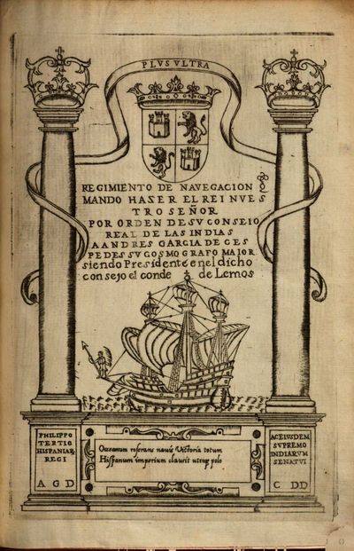
Why is the decolonization of the history of modern science and technology important? So that we can understand why Francis Bacon’s iconic title page image of a European caravella navigating through the pillars of Hercules in his book Instauratio Magna (Great Instauration, 1620) or Novum Organum Scientiarum (“new instrument of science”), which indicated the new program for modern empirical (colonial) scientific development, was actually taken from Andrés García de Céspedes’s book, Regimiento de navegación (Madrid, 1606). This shows the Northwestern European (Dutch, British, German), Protestant hegemonic shift, which stigmatized the downfall of “luxurious”, “inefficient”, “rapacious”, “unindustrialized”, “state-led capitalist” Spain, the Iberian or Southwestern European imperial-colonial project, against the “industrial revolution” and “scientific revolution” of the Northerners, the latter of which the image became a symbol. The deconstruction of this narrative is important in revealing the concealed global histories of colonial scientific and technological development, which was partly a precondition for the development in the new hegemonic centre in Europe. The South American decolonialist approach might be an important influence in decolonizing Eastern European knowledge production, since the Northwestern-Atlantic-Protestant narrative of scientific development, largely present in social scientists’ work such as Max Weber or Karl Marx, was dominantly diffused in Eastern Europe as our Eurocentric understanding of global scientific and economic development. I was educated according to this narrative already in primary school. This story will be included in my chapter on decolonizing Eastern European history of science and technology in the book Technosciences of Post/Socialism planned to be published somewhere in 2018.

Credit goes to Jorge Cañizares-Esguerra‘s work in which I’ve read about parts of the argument I am making. Read a brief overview on William Eamon’s blog.

For those more professionally engaged in the history of science, find a superb overview of annotated literature here.

Two new abstracts sent to ICHG2018 and AAG2018

My latest plan is to send two abstracts to the 17th International Conference of Historical Geographers in Warsaw, July 15-20 and one – the latter abstract here provided – to the Association of American Geographers Annual Meeting in New Orleans, April 10-14 in 2018. In the first case, the first abstract will hopefully be part of the following session:

– SESSION –

Global Histories of Geography 19301990

Convenors: Ruth Craggs (King’s College London) and Hannah Neate (Manchester Metropolitan University)

Reflecting on the key centres associated with the emergence of geography as a spatial science in the 1960s Barnes (2002, 508) remarked: “Why are places in Africa not on there, or Asia, or Australasia?” thereby highlighting significant gaps in disciplinary histories and accounts of geography’s development in the second half of the twentieth century. By way of response, this session aims to highlight work into the ‘global’ histories of geography in the period 1930-1990, a period marked by geopolitical transitions including WWII, decolonization and the end of the Cold War.  We are looking to make links with scholars who are carrying out research on the history and practice of geography, specifically in submissions that explore scholarly communities of geographers whose contribution to the development of geography in the twentieth century often goes unrecognised in the ‘canon’ of geographical research.

Possible themes for papers:

  • Papers focusing on geographers from the global South, Indigenous geographers in settler states, Asian geographies and geographers, geographers from the former Eastern Block
  • Biographies of individuals or groupings of geographers
  • Accounts that highlight how geography was being pursued in other ‘centres’
  • The role and development of national and international disciplinary associations and networks
  • Geographical knowledge, expertise and intersections with decolonization and the end of the Cold War

– ABSTRACTS –

Historical geographies of the “quantitative revolution”: Towards a transnational history of central place theory

Geography’s “quantitative revolution” has been a true textbook chronicle in the discipline’s canonical history. However, historical research has only recently seriously begun to unravel the geographical contexts of its emergence, which is complicated by the simplified narratives that emerged in critical revisionism from the 1970s. This paper offers an interpretative framework from the perspective of the historical geographies of scientific knowledge (HGSK), by focusing on Christaller’s central place theory (CPT) to deconstruct the common Anglo-American narrative, arguing that it has concealed other contexts in the “Second” and “Third” worlds. Early applications (especially in Germany, Poland, Netherlands, Israel) and the wider European discourse of “central places” call for a reevaluation of the canonized narratives of CPT. The globalization of CPT is interpreted through the rising American hegemony in the early Cold War era, which led to the Americanization of German location theories in modernization theory discourse. Networks behind the American, British and Canadian centres show the importance of European locations, such as the Swedish hub in Lund, and the “planning laboratories” of Asian, South American and African contexts after decolonization. Soviet and Eastern Bloc reformism and the institutionalization of regional planning from the late 1950s summoned CPT in the service of centralized state planning, and ignited debates of adaptability between “socialist” and “capitalist” contexts. By reflecting on some of these cases, this paper argues for a transnational history of CPT by readdressing issues of narrativity and historical periodization, and shows the need for provincializing and decolonizing dominant Anglo-American geographical knowledge production.


“The Ghana job”: Opening Hungary to the developing world

Based on interviews, archival and media sources, this paper looks at how post-WWII socialist Hungary developed foreign economic relations with decolonized countries, by focusing on the emergence of Hungarian development and area studies and development advocacy expertise towards developing countries. The paper’s case study is the Centre for Afro-Asian Research (CAAR) founded at the Hungarian Academy of Sciences in 1963 – from 1973 the Institute for World Economy (IWE) – parallel to similar institutions founded in the Soviet Union and other Eastern Bloc states. CAAR was established as a government think tank by József Bognár, a close friend to Prime Minister János Kádár and perhaps one of the most important figures in socialist era Hungarian reform economics and foreign policy-making. The institute rose as a consequence of the “Ghana job”: Hungarian economists led by Bognár developed the First Seven-Year Plan of Ghana in 1962. The associates of CAAR and IWE promoted export-oriented growth against import-substitution industrialization and summoned geographical development concepts such as “poorly developed countries”, “dependency”, “semiperiphery”, “open economies”, or “small countries” as alternatives to the Cold War categories of “capitalist” and “socialist” world systems. This shift in geographical knowledge production is connected to the geopolitical contexts of the Sino-Soviet split, the Khrushchevian “opening up” of foreign relations, the emergence of the “Third World”, and also the 1956 revolution in the case of Hungary. The role of Ghana and the Eastern Bloc is connected to the 1960s wave of transnational development consultancy and strategies of “socialist globalization”.

Richard Hartshorne’s racism

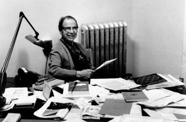
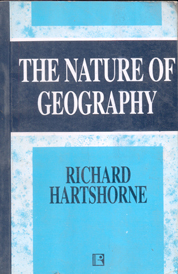
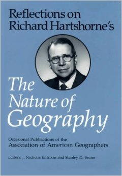
In my research, I’ve done some investigation on the debates of American geography between the 1920s and 1950s. Today, I’ve just encountered an incredible quote from the eminent American geographer, Richard Hartshorne, author of a once almost biblical text on the history of geography, The Nature of Geography (1939), and who was active during the noted period. This is the guy in his authentic environment and his tome.

According to textbook narratives and all academic pieces on him to date, as a political geographer he was generally troubled by environmental determinists and eugenicists of the time, and I previously thought of him as a sort of liberal, who was against racial prejudice and the tenets of physical anthropology. As the story goes, many geographers such as Hartshorne became increasingly disillusioned by these insidious thoughts, the abandonment of which was further encouraged by the growing mainstream American antipathy for Nazism and Fascism in Europe in the mouth of WWII. This is the American narrative.

Now, here’s the quote from the first page of the 1938 article in question:

“However, in place of this problem of national minorities the United States has more permanent problems of racial minorities – problems in a form essentially unknown in Europe. The differences between French and English, Germans and Poles, or even Swedes and Finns, Rumanians and Magyars are essentially cultural, not biological. Germans have become French and Poles have become Germans in two generations. So far as appearance is concerned, the barber and the tailor can make the change in a day. But no amount of education can change into white Americans the descendants of the negroes who arrived in Virginia before the Pilgrims landed at Plymouth, just as no beauty shop can make a fullblood negro look like a white person.” (p. 276)

Hartshorne’s racial definitions here are purely statistical, and he does not provide any analytical arguments for the distribution of races, only a descriptive account on the data and some basic geographical factors connected to regional divisions in labour and industry. He uses the definitions and data of the United States Bureau of the Census, 1930. As he explains:

“We shall not enter into the argument regarding what is meant by “race.” Our interest is in social and political situations that arise from obvious biological differences, and we can therefore accept the ordinary interpretation of racial terms as used in this country. In the United States apparently the only definition of a negro is one who is known to be a negro; i.e. one who, either because of obvious physical characteristics, chiefly color, or because of known origin, is recognized as having any degree of negro ancestry, regardless of how much white ancestry he may also have.” (p. 277)

The same is the case with the other races identified, the Mexicans, Indians and “Orientals”. For example, Mexicans are said to be Indians speaking Spanish, who could be “recognized on sight”. The only thing he argues against concerning some very racist ideas is climatic determinism in the “negro case”:

“But it is clear from the map that this is not a direct reflection of climate, as some foreign observers have supposed. The large number of negroes in Northern cities cannot be dismissed as exceptions; nor can the absence of negroes in many Southern districts be explained climatically.” (p. 277)

Why is this whole stuff flabbergastingly interesting? Well… as previously noted, my humble impression is that

there is still almost complete silence on the racial ideas of American geographers who were NOT commemorated as well-known eugenicists or environmental determinists of the time.

You can read about the racisms of Ellsworth Huntington, Griffith Taylor, or maybe the more moderate Ellen Churchill Semple. Neil Smith has written on Isiah Bowma416QJHWKYYL._SY344_BO1,204,203,200_n’s racism in his The American Empire (2004), but I could find only some littered personal accounts on the racism of other important geographers, like Carl Ortwin Sauer (this calls for another post). There aren’t even traces of reflection on these issues in any of the most prominent accounts on the history of American geography, like in David Livingstone’s The Geographical Tradition (1992), Ron J. Johnston’s (and James D. Sidaway’s) Geography and Geographers (2015), Richard Peet’s Modern Geographical Thought (1998), Geoffrey J. Martin’s American Geography and Geographers (2015) or his All Possible Worlds (2005), just to name a few, and nor in Reflections on Richard Hartshorne’s Nature of Geography (1989).

In sum, it seems to me that the reevaluation of the racial thought of a wider field of American geographers is yet to be done in light of contemporary racial discourses and political thought.

By the way, here are the maps, just for fun.

Ehhez a diavetítéshez JavaScript szükséges.

Hartshorne, Richard (1938): Racial Maps of the United States. Geographical Review, 28(2) p. 276-288.